
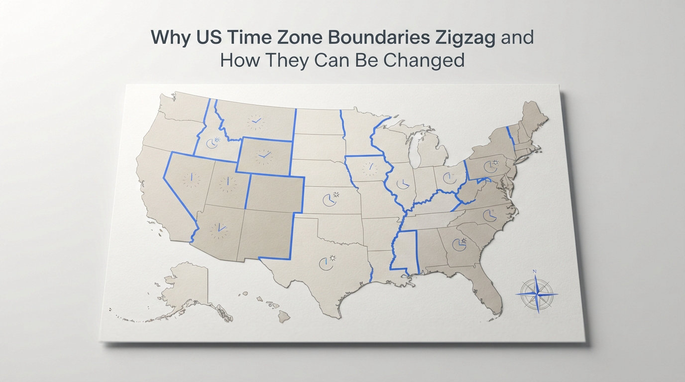
If you have ever stared at a map of US time zone boundaries, you probably noticed something odd right away. The lines do not follow clean, straight paths of longitude. Instead, they zigzag, dip, and dart across state borders in ways that seem almost random at first glance.
There is a reason for every twist and turn. US time zone boundaries zigzag because they are drawn around commerce, community ties, and transportation patterns rather than strict geographic coordinates. When the railroads first created standard time in 1883, they prioritized keeping connected cities in the same zone over following neat lines of longitude. That principle still governs every boundary on the map today.
In this guide, I will walk you through why these lines look the way they do, share specific examples of the strangest zigzag boundaries in the country, and explain exactly how a community can petition to change its time zone. Whether you live on a boundary line, are studying geography, or are just curious about the quirks of American timekeeping, you will find the answers here.
One thing to know upfront: time zone boundaries are not permanent. They can be changed. The Department of Transportation has a formal process for it, and communities across the country have used it dozens of times. I will break down that process step by step, along with recent attempts that succeeded and failed.
Table of Contents
Why US Time Zone Boundaries Zigzag
US time zone boundaries zigzag because they are built around commerce and community connections, not mathematical lines of longitude. Every bend and notch in a boundary line exists to keep economically linked areas operating on the same clock.
That is the short answer. The longer story starts in the 1880s and involves railroads, dozens of local time standards, and a landmark shift that changed how the entire country told time.
Before Standard Time: A Chaotic Patchwork
Before 1883, the United States had no standardized time zones. Every town and city set its clocks based on local solar time, meaning noon was whenever the sun reached its highest point in the sky. That system worked fine when travel was slow.
But as railroads expanded across the country, the chaos became a real problem. By the early 1880s, American railroads were dealing with over 144 different local times. A single railroad station could have three or four clocks showing different times for different train lines. Scheduling was a nightmare, and missed connections were common.
Something had to give. The railroads decided to fix it themselves.
The Day of Two Noons: 1883
On November 18, 1883, the major railroad companies adopted a system of four standard time zones: Eastern, Central, Mountain, and Pacific. This day became known as “The Day of Two Noons” because many towns experienced noon twice, once on local time and once on the new standard railroad time.
The railroads did not draw the boundaries along perfect longitude lines. They adjusted the zones to keep major cities and their railroad connections in the same time zone. Detroit, for example, was placed in Central Time even though its longitude suggested Eastern Time, because its primary railroad connections ran westward.
This principle, keeping commercially connected areas together, became the foundation of every boundary decision that followed. It is exactly why the lines zigzag instead of running straight north to south.
Federal Government Steps In: 1918
The railroad time zones worked well enough that cities and states gradually adopted them. But there was no federal law requiring it. States and local jurisdictions could still choose their own time, and many did.
In 1918, Congress passed the Standard Time Act, also known as the Calder Act. This was the first federal law establishing standard time zones in the United States. It placed authority over time zone boundaries with the Interstate Commerce Commission (ICC), reflecting the idea that time zones were fundamentally about interstate commerce.
The 1918 law also introduced daylight saving time to the United States, though that provision was repealed after World War I and went through several more changes over the decades.
The Uniform Time Act of 1966: DOT Takes Over
By the 1960s, time zone confusion had reached a breaking point. Some states observed daylight saving time and some did not. Within individual states, different counties sometimes ran on different time zones. A person could drive a short distance and cross multiple time zone boundaries.
Congress responded with the Uniform Time Act of 1966. This law standardized daylight saving time observance across the country and transferred authority over time zone boundaries from the ICC to the newly created Department of Transportation (DOT). The DOT has held that authority ever since.
The legal standard the DOT uses to evaluate boundary changes is called “convenience of commerce.” This means the DOT considers how a proposed change would affect business ties, transportation, communication, broadcasting, and community connections. Geography is a factor, but commerce is the deciding test.
This framework, established in 1966, is why US time zone boundaries still zigzag in 2026. Every irregularity on the map tells a story about which communities do business together, which media markets they share, and which transportation routes connect them.
Notable Zigzag Boundaries: State-by-State Examples
The most visible zigzag boundaries in the United States appear where time zone lines cut through states instead of following their borders. Thirteen states are split between two time zones, and each split has its own historical and commercial logic.
Here are the most striking examples of zigzag boundaries, with the stories behind why the lines land where they do.
Tennessee: Split Along the Cumberland Plateau
Tennessee is one of the clearest examples of a zigzag boundary. The state is divided between Eastern Time and Central Time, with the line cutting through the eastern third of the state.
The split roughly follows the Cumberland Plateau, a natural geographic barrier that historically separated communities. Cities east of the line, including Chattanooga and Knoxville, sit in the Eastern Time Zone. Their economic and cultural ties run toward Atlanta and the East Coast.
West of the line, Nashville, Memphis, and the rest of the state operate on Central Time. Their business connections point toward the Midwest and the Gulf Coast. The boundary zigzags because it traces county lines where local commerce patterns shifted from east-facing to west-facing.
Kentucky: Western Counties on Central Time
Kentucky mirrors Tennessee’s split. The eastern half of the state, including Lexington and Louisville, runs on Eastern Time. The western portion, including Bowling Green and Paducah, observes Central Time.
The logic is the same as in Tennessee. Western Kentucky’s commerce and transportation ties run toward Nashville and the Midwest. Eastern Kentucky’s connections point toward Cincinnati, West Virginia, and the Atlantic seaboard.
The boundary does not follow a straight line. It weaves through counties based on where those commercial connections shift, creating the zigzag pattern visible on any time zone map.
Indiana: A Boundary That Moved Multiple Times
Indiana has one of the most complicated time zone histories in the country. For decades, most of the state observed Eastern Time but refused to observe daylight saving time, creating a twice-yearly shuffle where Indiana was effectively on Central Time during summer months.
In 2005, the Indiana General Assembly passed a law requiring the entire state to observe daylight saving time starting in 2006. This triggered a wave of county-level petitions to the DOT, asking to switch from Eastern to Central Time or vice versa.
Today, 12 Indiana counties observe Central Time. Six are in the northwest corner near Chicago, including Lake, Porter, LaPorte, Newton, Jasper, and Starke Counties. Their economies are tied to the Chicago metropolitan area, which runs on Central Time. Six more are in the southwest near Evansville, including Gibson, Posey, Vanderburgh, Warrick, Spencer, and Perry Counties.
The boundary between Indiana and Illinois does not perfectly follow the state line. Instead, it jogs through Indiana’s counties, reflecting where each community’s commercial gravity points, toward Chicago or toward Indianapolis.
The Florida Panhandle: Central Time at the Western Edge
Florida is split between Eastern and Central Time, but the division does not affect the whole state. Only the northwestern panhandle region observes Central Time.
The boundary runs roughly along the Apalachicola River in the Florida panhandle. Cities like Pensacola, Panama City, and Fort Walton Beach operate on Central Time. Their economic ties run toward Mobile, Alabama, and the Gulf Coast, not toward the Atlantic side of Florida.
Tallahassee, located just east of the boundary line, observes Eastern Time. The zigzag exists because the panhandle’s communities are commercially and culturally connected to the Central Time zone states along the Gulf.
Texas: El Paso in Mountain Time
Most of Texas runs on Central Time, but the far western tip of the state, including El Paso, observes Mountain Time. El Paso’s economy and culture are deeply tied to neighboring New Mexico, which runs on Mountain Time.
Two counties in far west Texas, El Paso County and Hudspeth County, are in the Mountain Time Zone. The boundary creates a sharp zigzag at the western edge of the Central Time zone, reflecting the commercial reality that El Paso looks west, not east.
The Dakota, Nebraska, and Kansas Splits
North Dakota, South Dakota, Nebraska, and Kansas are each split between Central and Mountain Time. The boundaries zigzag through the Great Plains, generally tracking where agricultural commerce flows east toward Minneapolis and Chicago versus west toward Denver.
These splits can create confusion in rural areas. Some counties in western North Dakota petitioned to switch from Mountain to Central Time in recent decades, reflecting a shift in their business connections.
Idaho and Oregon also have splits. The panhandle of Idaho and parts of eastern Oregon observe Mountain and Pacific Time respectively, while the rest of those states follow a different zone. Michigan’s Upper Peninsula includes a small area of Central Time near Wisconsin.
Counting all of these, thirteen states are split between two time zones. Each boundary zigzags for the same underlying reason: commerce, not cartography, draws the line.
How Time Zone Boundaries Can Be Changed
Time zone boundaries in the United States can be changed through two formal methods: by statute, where Congress passes a law, or by regulation, where the Secretary of Transportation approves a change through the rulemaking process. The regulatory path is by far the most common.
Here is how the petition process works, step by step.
Step 1: Submit a Request to the DOT
Anyone can submit a request to move an area from one time zone to another. The request goes to the Office of the General Counsel at the Department of Transportation. In practice, most requests come from state legislatures, local governments, or chambers of commerce.
The request needs to identify the area seeking the change and explain why the change would serve the convenience of commerce. Supporting evidence, such as data on business ties, transportation patterns, and community connections, strengthens the request significantly.
Step 2: The DOT Reviews for Convenience of Commerce
The DOT evaluates every request against the “convenience of commerce” standard established by the Uniform Time Act. This is not a vague concept. The DOT looks at specific, measurable factors.
Those factors include where local businesses buy and sell goods, which media markets serve the area, what transportation routes connect the community to neighboring areas, where children attend school, and how closely the community is tied to areas in the proposed time zone. The DOT also considers existing boundary lines and whether a change would create new inconsistencies.
This is the key test. If an area can demonstrate that its commercial and social ties align more closely with a neighboring time zone, the DOT has grounds to approve the change.
Step 3: Public Hearings and Comment Period
If the DOT determines a request has merit, it initiates a formal rulemaking process under the Administrative Procedure Act. This includes publishing a notice in the Federal Register and opening a public comment period.
The DOT may also hold public hearings in the affected area. These hearings give residents, business owners, and local officials a chance to voice support or opposition. Public input carries real weight in the DOT’s final decision.
Step 4: The Secretary of Transportation Makes a Decision
After reviewing the evidence and public comments, the Secretary of Transportation issues a final determination. The decision is based on whether the change promotes the convenience of commerce.
Decisions are not always yes or no. The DOT may approve a change, deny it, or modify the proposed boundary. The entire process typically takes six months to a year, though complex cases can take longer.
Step 5: Implementation
If approved, the DOT amends the time zone boundary in the Code of Federal Regulations, specifically 49 CFR Part 71. The change takes effect on a date set by the DOT, usually with several months of advance notice so residents and businesses can prepare.
State legislatures may also need to pass conforming legislation, particularly regarding daylight saving time observance. The federal change defines the boundary, but states still have some flexibility in how they observe time within it.
Recent Attempts to Redraw the Time Zone Map
Time zone boundaries are not set in stone. Communities across the country have petitioned the DOT to change their time zone in recent decades, with mixed results.
Indiana’s 2005-2006 Realignment
The most significant recent time zone change happened in Indiana. When the state legislature voted in 2005 to observe daylight saving time statewide, it triggered a rush of county-level petitions to the DOT.
Multiple counties asked to switch zones. Some wanted to move from Eastern to Central Time, arguing their economies were tied to Chicago or the Midwest. Others petitioned to stay in Eastern Time. The DOT held hearings, reviewed evidence, and made individual determinations for each county.
The result was a partial realignment. Some counties switched, others did not. The Indiana case demonstrated both how the petition process works and how difficult it is to satisfy every community.
Florida’s Sunshine Protection Act
In 2018, Florida passed the Sunshine Protection Act, which would keep the state on daylight saving time year-round. The law passed the state legislature and was signed by the governor.
However, federal law currently prohibits states from adopting year-round daylight saving time without congressional approval. As of 2026, the Florida law remains in a holding pattern, waiting for Congress to act. Several other states have passed similar laws, creating a patchwork of unenforceable state-level DST mandates.
County-Level Petitions Across the Country
Beyond these high-profile cases, numerous county-level petitions have been filed with the DOT over the years. Counties in North Dakota, Texas, Alabama, and other states have requested time zone changes.
Pike County, Alabama, near the Florida border, petitioned to move from Central to Eastern Time to align with its business ties. Some western North Dakota counties successfully shifted from Mountain to Central Time as their economic connections moved eastward.
Not every petition succeeds. The DOT has denied requests where the evidence did not clearly demonstrate that a change would serve the convenience of commerce. Community opposition is also a common factor in denials.
The Pattern: Commerce Drives Change
Looking at recent attempts, a clear pattern emerges. Successful petitions share common elements: strong evidence of commercial ties to the target time zone, organized community support, and alignment with transportation and media market patterns. Failed petitions typically lack sufficient evidence or face significant local opposition.
Living Near a Zigzag Time Zone Boundary
For most Americans, time zones are a set-it-and-forget-it detail. But for people living near a zigzag boundary, the time zone line is a daily reality that affects everything from work schedules to school pickup times.
Forum discussions on Reddit and other platforms reveal just how disruptive boundary life can be. One user living on the Eastern-Central boundary described the experience plainly: their phone auto-adjusts when they cross the line, but their brain does not.
Scheduling Chaos Across the Line
People who commute across a time zone boundary face constant mental math. A worker living in Central Time and commuting to an Eastern Time job effectively starts and ends their day an hour earlier. Parents juggling school pickups across zones have to track two clocks at all times.
Business owners face even bigger headaches. Payroll calculations, meeting scheduling, and delivery coordination all become more complex when employees or customers are in different time zones. One forum user described struggling to manage staff schedules when half the team was in Central Time and half in Eastern.
Broadcasting and Commerce Challenges
Media markets frequently span time zone boundaries, creating confusion for television and radio programming. A show that airs at 8 PM Eastern might start at 7 PM for viewers just across the line in Central Time. Local businesses running ads have to account for these differences.
Despite these challenges, most boundary communities have adapted. The zigzag boundaries exist because, on balance, they keep communities aligned with their primary commercial and social connections. The daily inconveniences are the trade-off for that alignment.
Frequently Asked Questions
Why do time zones zigzag?
Time zones zigzag because their boundaries are drawn around commerce and community ties, not straight lines of longitude. When the railroads created standard time zones in 1883, they adjusted the lines to keep economically connected cities in the same zone. The Department of Transportation continues this practice today, using the convenience of commerce standard to evaluate every boundary.
How can time zone boundaries be changed?
Time zone boundaries can be changed in two ways: by statute, where Congress passes a law, or by regulation, where the Secretary of Transportation approves a change through the formal rulemaking process. A community submits a request to the DOT, which reviews it under the convenience of commerce standard, holds public hearings, and issues a determination.
What is the convenience of commerce standard?
The convenience of commerce is the legal test the Department of Transportation uses to evaluate time zone change requests. It considers where local businesses buy and sell goods, which media markets serve the area, transportation connections, school district alignment, and community ties to neighboring areas in the proposed time zone.
Which states are split into two time zones?
Thirteen US states are split between two time zones: Florida, Indiana, Kentucky, Michigan, Tennessee, Texas, North Dakota, South Dakota, Nebraska, Kansas, Alaska, Idaho, and Oregon. Each split exists because commercial ties in different parts of the state point toward different regions.
Where does the time change between Indiana and Illinois?
The time zone boundary between Indiana and Illinois does not perfectly follow the state line. Twelve Indiana counties observe Central Time: six in the northwest near Chicago and six in the southwest near Evansville. The rest of Indiana operates on Eastern Time. The boundary jogs through Indiana based on where each county’s commercial connections point.
Who has authority to change time zones in the US?
The Secretary of Transportation has authority to change time zone boundaries in the United States. This authority was granted by the Uniform Time Act of 1966, which transferred oversight from the Interstate Commerce Commission to the DOT. Congress can also change boundaries by passing a federal statute.
The Bottom Line on Zigzag Time Zone Lines
US time zone boundaries zigzag for a simple reason: they follow people and commerce, not lines on a globe. Every notch, jog, and dip in a boundary line represents a decision about which communities belong together on the same clock.
The system is not perfect. People living near boundary lines deal with daily inconveniences that most Americans never think about. But the trade-off is that communities stay aligned with the markets, media, and transportation networks that matter most to their daily lives.
If your community feels like it is in the wrong time zone, the DOT petition process is available. It takes time and evidence, but it has worked for counties across the country. The boundaries that zigzag across our maps today are the product of decades of those same petitions, hearings, and commerce-driven decisions.
Understanding why US time zone boundaries zigzag means understanding how America does business. The lines on the map are really a record of how communities connect, trade, and grow together.